The Karakoram Highway, also known as N-35 or National Highway 35 or the China-Pakistan Friendship Highway, is a 1,300-kilometre (810 miles) national highway that runs from Hasan Abdal in Punjab to the Khunjerab Pass in Gilgit-Baltistan. Where it crosses into China and becomes China National Highway 314. The highway links Punjab, Khyber Pakhtunkhwa and Gilgit-Baltistan provinces with China’s Xinjiang Uyghur Autonomous Region.
The highway is a popular tourist destination and one of the world’s highest paved roads, passing through the Karakoram mountain range at a maximum elevation of 4,714 metres (15,466 feet) near Khunjerab Pass. It is often referred to as the “Eighth Wonder of the World” due to its high elevation and the difficult conditions under which it was built. The highway also connects to the Asian Highway AH4.
Route Specification:
Part of the AH4 Asian Highway, maintained by Pakistan’s National Highway Authority (NHA) and the Xinjiang Uyghur Autonomous Region’s Transport Department (China)
Length 1,300 kilometres (810 mile)
Pakistan is 887 kilometres (551 mile) while
413 kilometres (257 mile) in China
1966–present
Completed in 1979, it has been open to the public since 1986.
The North End:
Kashgar, Xinjiang Province, China
China National Highway 314 (Khunjerab Pass-Kashgar-Ürümqi) svg Kokudou 314 (China)
South End:
Hasan Abdal, Punjab, Pakistan
Major cities
Haripur, Abbottabad, Mansehra, Battagram, Besham, Pattan, Dasu, Chilas, Gilgit, Aliabad, Gulmit, Sust, Tashkurgan, Upal, Kashgar.
History of Karakoram Highway:
Pakistan and China collaborated to build the Karakoram Highway. It began in 1962 and was completed in 1979. Pakistan initially preferred the Mintaka Pass route. In 1966, China recommended the steeper Khunjerab Pass, citing the fact that Mintaka would be more vulnerable to air strikes. During the construction of the highway, 810 Pakistanis and 200 Chinese workers were killed, mostly in landslides and falls. Over 140 Chinese workers who died are buried in the Chinese cemetery, in Gilgit. The KKH follows one of the many paths of the ancient Silk Road.
The Book:
The book “History of Karakoram Highway” was written by Brigadier (Rtd.) Muhammad Mumtaz Khalid in two volumes. In the first volume, the author discusses the land and people, the prehistoric communication system in the Northern Areas, the need for an all-weather road in Gilgit-Baltistan and the construction of the Indus Valley Road. In the second volume, he documented the events that led to the conversion of the Indus Valley Road to the Karakoram Highway, the difficulties encountered during construction and the role of the Pakistan Army Corps of Engineers and their Chinese counterparts.
Strategic Importance:
The highway passes through the collision zone between the Eurasian and Indian plates. There China, Tajikistan, Afghanistan, and Pakistan are only 250 kilometres (160 miles) apart. The Karakoram Highway is strategically and militarily important to these nations, Pakistan and China, owing largely to the extremely sensitive state of the Kashmir conflict between India and Pakistan.
Reconstruction & Extension:
On June 30, 2006, the Pakistani National Highway Authority (NHA) and China’s State-owned Assets Supervision and Administration Commission (SASAC) signed a memorandum of understanding to rebuild and upgrade the Karakoram Highway. According to SASAC, the width will be increased from 10 to 30 metres (33 to 98 feet), and the transport capacity will be increased threefold. Furthermore, the upgraded road will be specifically designed to accommodate heavy-laden vehicles and extreme weather conditions.
China and Pakistan intend to connect the Karakoram Highway to the Southern port of Gwadar in Balochistan via the Chinese-aided Gwadar-Dalbandin railway, which will extend to Rawalpindi.
The KKH in the Hunza Valley was closed on January 4, 2010, eliminating all through traffic to China except small boats. A massive landslide 15 kilometres (9.3 miles) upstream from Hunza’s capital of Karimabad formed the potentially unstable Attabad Lake, which grew to 22 kilometres (14 miles) in length and more than 100 metres (330 feet) in depth by the first week of June 2010 when it finally began to flow over the landslide dam. The landslide destroyed parts of villages and killed many people. The subsequent lake displaced thousands and inundated over 20 KM (12 miles) of the KKH, including 310 metres (1,020 feet) long bridge, 4 KM (2.5 miles) South of Gulmit.
It was highly doubtful that the lake, which measured 27 kilometres (17 miles) in length in 2011, would drain. Small vessels transported goods from and to the North across the lake, where they were reloaded onto trucks at the other end. Pakistan began constructing a revised route around the lake at a higher elevation in July 2012, with five new tunnels totalling 7.12 kilometres in length and two new bridges. The project was contracted out to the China Road & Bridge Corporation (CRBC) and finished in September 2015.
Pakistani Section:
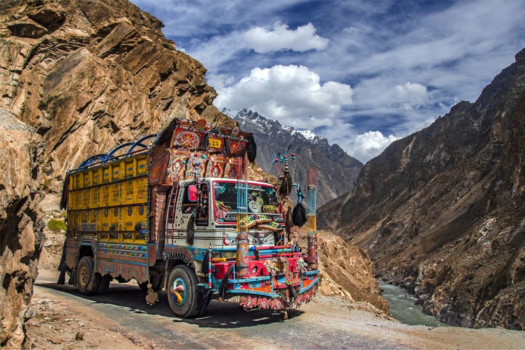
The Pakistani section of the highway begins near Abbottabad and runs for 806 kilometres (501 miles) of which the KKH is now a part, officially beginning from Hasan Abdal. The highway crosses the Indus River at Thakot and continues along it until it reaches Jaglot, where the Gilgit River joins the Indus. Three great mountain ranges meet here; the Hindu Kush, the Himalayas and the Karakoram. Nanga Parbat, the world’s ninth-highest peak, can be seen from the highway.
The highway runs through Gilgit and continues along the Hunza River through the valleys of Nagar and Hunza. This section contains some of the highest mountains and most famous glaciers in Karakoram. At Khunjerab Pass, the highway crosses the Pakistan-China border.
The Pakistani portion of the Karakoram Highway (KKH) is being rebuilt and upgraded as part of the $46 billion China-Pakistan Economic Corridor. The existing M1 motorway will intersect the Karakoram Highway at Burhan Interchange near Hasan Abdal. From there, access to Islamabad and Lahore is maintained via the existing M1 and M2 highways, while Hasan Abdal will also be at the crossroads of the Eastern and Western Alignments, which will lead to the port city of Gwadar.
Realignment of KKH:
When a large section of the highway was damaged by a landslide in 2010, all vehicular traffic had to be loaded onto boats to cross the new reservoir. The tunnels’ construction began in 2012 and took 36 months to complete. This 24 KM (15 miles) long series of bridges and tunnels cost $275 million. It was inaugurated on September 15, 2015, and was hailed as a major accomplishment.
The route includes five tunnels and some bridges. The 3,360 metres (11,020 feet) long tunnel is followed by 2,736 metres (8,976 feet), 435 metres (1,427 feet), 410 metres (1,350 feet), and 195 metres (640 feet) respectively. Shishkat Bridge on the Hunza River is 1,480 metres (4,860 feet) high. The realignment restored Pakistan’s road link to China.
KKH connects expeditions to nearly all peaks in Gilgit-Baltistan, Kashmir and several peaks in Xinjiang, China. The area is home to some of the world’s largest glaciers, including the Baltoro and Siachen Glaciers. Two of the world’s 8,000ers are in Pakistan and can be seen via highway. Some notable mountains are as follows.
Nanga Parbat, 9th highest in the world at 8,126 metres (26,660 feet)
Rakaposhi, 27th highest in the world at 7,788 metres (25,551 feet)
Diran, the most dangerous mountain in Pakistan
Shishpar
Ultar Peak
Tupopdan, also known as Cathedral Peak near Passu.
The glaciers can be seen while travelling on the highway.
Minapin Glacier
Passu Glacier
Ghulkin Glacier
Khunjerab Glacier
Several rivers and lakes are accessed by the highway.
Indus River
Hunza River
Attabad Lake
Gilgit River
Khunjerab River
Karakul Lake in Xinjiang (China)
Rock art and Petroglyphs
More than 50,000 pieces of rock Art and Petroglyphs can be found along KKH. These are concentrated at ten major sites between Hunza and Shatial. Invaders, traders and pilgrims who travelled along the trade route, left carvings. The earliest are from between 5000 and 1000 BC, depicting single animals, triangular men and hunting scenes in which the animals outnumber the hunters. These carvings were printed into the rock with stone tools and have a thick patina that indicates their age.
Travel:
There are several bus services between major cities to Northern Areas. NATCO is the largest transportation corporation. Masherbrum Travel, Silk Route Travel, K-2 Movers, Anchan Travel and Saeed Travel are some of the other companies.
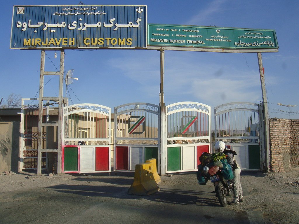
Bus service began between Gilgit and Kashgar on 1 June 2006, on a daily basis, between Gilgit and Kashgar, Xinjiang, China. It is operational through Sust and Tashkurgan border area.
www.pakistanbikers.com now provide transportation services to tourists and locals as well. We deal in car/bike rental services on KKH. Tourists can travel by bike on KKH.
For the best tour packages and motorcycle tours, just contact us with full confidence.